
By Ahlam Alshammari, Durham University
Abstract
This report presents the results of fieldwork conducted in October 2025 across nine forts in Saudi Arabia as part of a PhD project examining the development of forts in Central Arabia. The research integrates architectural recording, spatial analysis, and material investigation to examine patterns in construction, organisation, function, and site distribution. A multi-method approach combining aerial survey, Geographic Information Systems (GIS), terrestrial laser scanning (LiDAR) at selected sites, and limited material sampling for radiocarbon (C14) dating was employed.
The results indicate significant variability in architectural forms and spatial configurations, reflecting differences in chronology, function, and regional context. Rather than representing a linear developmental sequence, the evidence suggests patterns of continuity, reuse, and adaptation of forts across Arabia.
1. Introduction
Forts constitute a significant yet insufficiently synthesised component of the archaeological landscape of Arabia. Although widely distributed, their origin, development, architectural variability, and functional roles remain inadequately understood within a comparative framework. Previous studies have often focused on individual sites, specific regions, or approached primarily from a defensive or military perspective, limiting broader interpretation.
This study addresses this gap through a systematic field-based investigation of forts in Central Arabia. The research focuses on forts within the landscape and their relationship with settlements, as well as their spatial organisation and construction techniques, with the aim of identifying patterns of continuity and variation across different chronological and regional contexts.
2. Sites Investigated
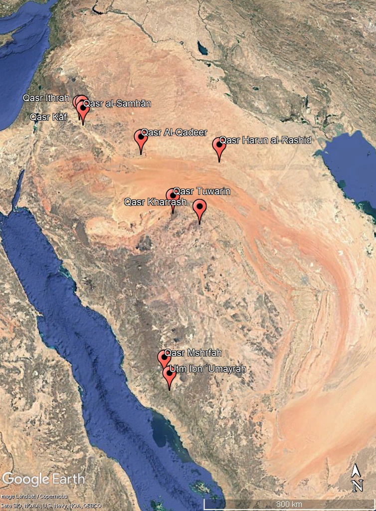 Figure 1: Location of the nine forts investigated during fieldwork (Author, 2025).
Fieldwork was conducted across nine forts representing a wide chronological range and diverse geographical contexts. The sequence below follows the order in which the sites were investigated in the field:
Qasr Kharrash – Early Islamic – Faid, Hail
Qasr Tuwarin – Pre-Islamic – Tuwarin, Hail
Qasr Harun al-Rashid – Early Islamic – Zubala, Rafḥā’
Qasr Ithrah – Early centuries CE (possibly Nabataean) – al-Qurayyāt, al-Jouf
Qasr al-Samhān – Early 20th century – al-Qurayyāt, al-Jouf
Qasr Kāf – Late Islamic – al-Qurayyāt, al-Jouf
Qasr al-Qadeer – Early Islamic (518 AH / 1124 CE) – Sakākā, al-Jouf
Uṭm Ibn ʿUmayrah – Modern (20th–21st century CE) – Qaryat Banī Saʿd, al-Ṭāʾif
Qasr Mushrifah – Late Islamic – (tentative) – al-Ṭāʾif
3. Methodology
A multi-method approach was employed across all sites. High-resolution aerial photography using a DJI Mini 3 drone enabled systematic documentation of architectural layouts and surrounding landscapes. GIS was used to integrate spatial data and analyse settlement patterns and topographic relationships.
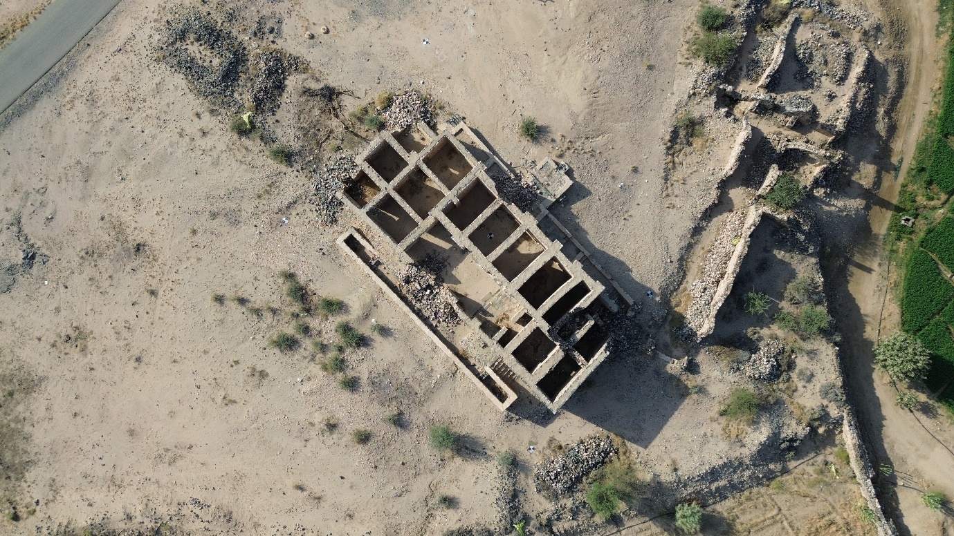 Figure 2: Drone orthophoto of Qasr Mushrifah in Ṭāʾif showing enclosure and internal layout (Author, 2025)
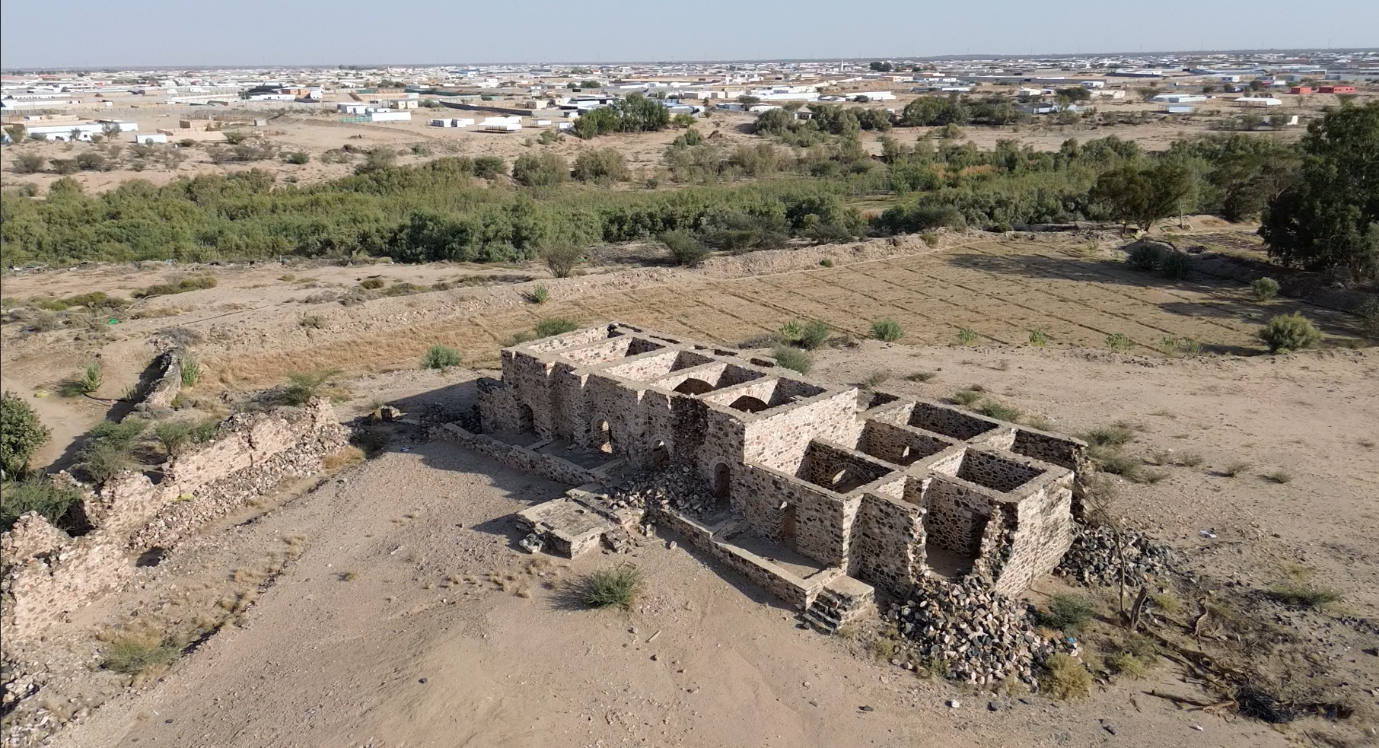 Figure 3: Oblique aerial view of Qasr Mushrifah illustrating the relationship between the enclosure and surrounding landscape (Author, 2025).
Architectural recording was undertaken using total station survey, while terrestrial laser scanning (LiDAR) was applied at selected sites, including Qasr Ithrah and Qasr Tuwarin, to capture high-resolution morphological data.
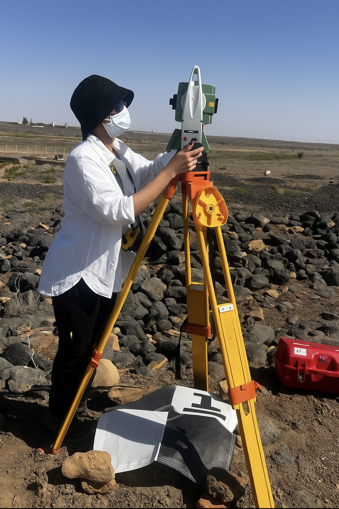
Figure 4: Total station survey at Qasr Kharrash in Hail (Author, 2025).
Archaeological material, including pottery sherds, was recorded and photographed in situ where present.
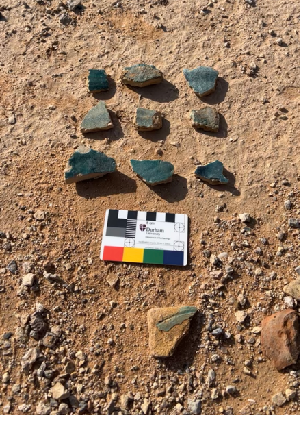
Figure 5: Surface pottery fragments observed in the field at Qasr Kharrash (Husn Faid), Hail (Author, 2025).
A plastered cistern associated with Qasr Harun al-Rashid was sampled for radiocarbon (C14) dating and submitted to the Scottish Universities Environmental Research Centre (SUERC). The results are pending and expected to refine the chronological framework of the site. The creation of three-dimensional digital models of the surveyed forts is currently in progress and will support further architectural analysis and comparative spatial interpretation.
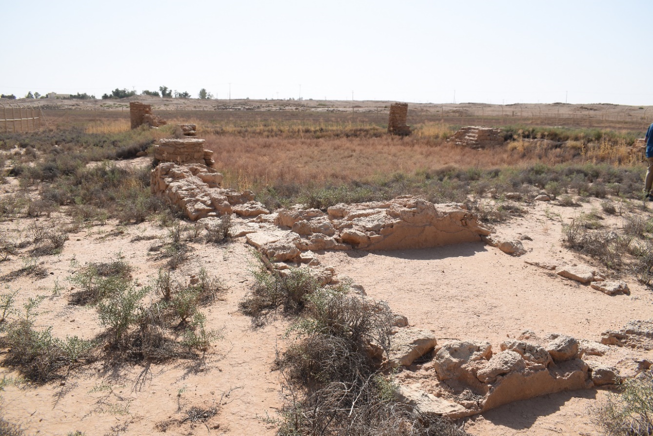 Figure 6: General view of the cistern showing overall condition and vegetation cover; the sampling area is located within this structure (Author, 2025).
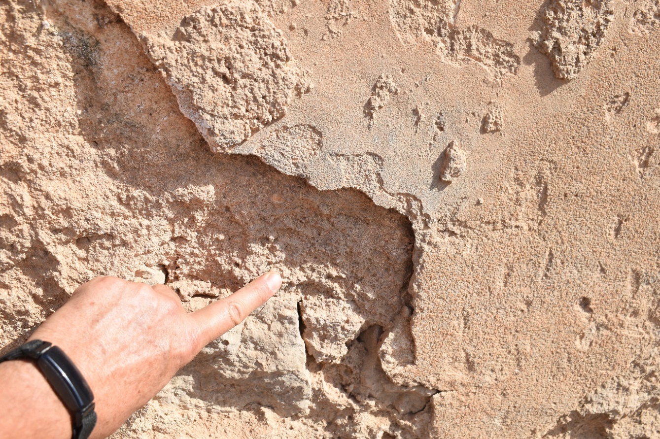 Figure 7: Sampling location indicated on the cistern wall (Author, 2025).
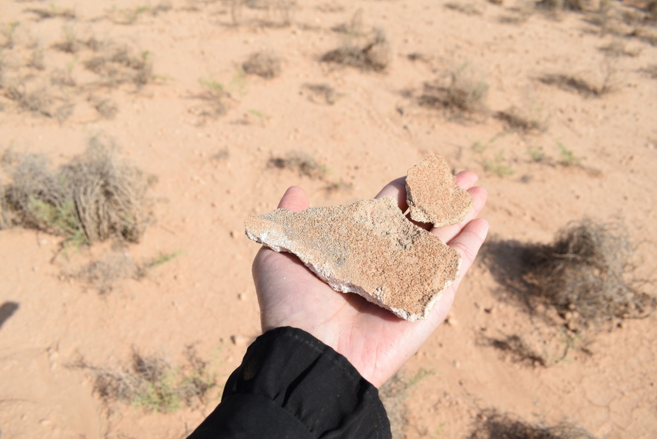 Figure 8: Collected material sample following extraction (Author, 2025).
4. Results
The surveyed forts demonstrate considerable variability in architectural form, construction technique, and spatial organisation. Some sites exhibit simple enclosed layouts, while others show more complex internal subdivisions. Variation is also evident in the presence or absence of defensive features, as well as in their inferred functions and relationships with surrounding settlements.
Spatial analysis indicates differing locational strategies. Several forts occupy elevated positions overlooking routes or valleys, suggesting roles related to surveillance or control. Others are integrated within settlement contexts, indicating multifunctional roles that combine habitation with local authority or management. Some sites are positioned along major communication routes, including pilgrimage (ḥajj) and trade networks, such as Qasr Kharrash at Faid in Hail.
Functional variability is further indicated at specific sites. For example, Uṭm Ibn ʿUmayrah appears to have served an observational role, potentially including astronomical functions, although this interpretation requires further investigation.
Chronologically, the sites reflect long-term occupation sequences spanning pre-Islamic, early Islamic, Ottoman, and early twentieth-century phases. This pattern suggests continuity and reuse rather than isolated construction episodes.
5. Conclusion
This study provides new empirical data on forts in Central Arabia and contributes to understanding their development as adaptive and context-dependent structures rather than fixed typological categories. The results presented here remain preliminary, as post-fieldwork analysis, including radiocarbon dating and digital modelling, is ongoing. These analyses will further refine chronological and functional interpretations.
Acknowledgement
This research was supported by a Small Research Grant from the International Association for the Study of Arabia (IASA). Fieldwork permissions, site access, and sampling authorisations were granted by the Saudi Heritage Commission, whose cooperation is gratefully acknowledged.


