The aim of my PhD research is to ascertain whether the new ALOS-2 Synthetic Aperture Radar (SAR) satellite imagery will be able to identify and facilitate mapping of water control technologies of Bronze Age Southern Arabia. This supports one of the primary goals of a larger ongoing project, the Archaeological Water Histories of Oman (ArWHO), which strives to “evaluate satellite radar imagery as a means to detect and map ancient irrigation and field systems” (Harrower 2013:1).
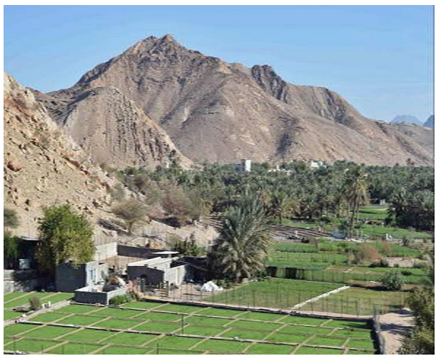
Remotely sensed (air and space) imagery has become an important dataset for use in the discovery of archaeological sites and features, and research into past human behaviours (Comer & Blom 2007; Comer and Harrower 2013; El-Baz and Wiseman 2007; Parcak 2009). L-band SAR data can penetrate several metres into dry, homogenous fine-grained materials such as the aeolian sands of the Sahara and Arabian Peninsula (Blom et al 2007; Paillou et al 2008). These wavelengths are then reflected (backscattered) off subsurface features (Chapman and Blom 2013) such as bedrock, coarser fluvial deposits (paleochannels) or compacted surfaces, providing a picture of previously untraceable paleolandscape or archaeological features. In regards to my research, this evaluation of radar imagery as an appropriate tool for the ArWHO project utilises the ability of ALOS-2 L-Band radar waves to penetrate the ground surface in order to detect falaj (channeled irrigation systems), or banked field systems. Modern aflaj (plural of falaj) and banked fields can be seen at many places within the project area, but it is difficult to interpret the relationship (if any) to their ancient predecessors. As the new ALOS-2 imagery has only recently become available, during the field season I worked with archived ALOS imagery (the predecessor satellite) that I was able to obtain with the BFSA grant. Based on my preliminary analysis, it appears that this archived imagery lacks adequate resolution required to identify our targeted subsurface archaeological remains. For example, the falaj are usually less than 1m wide and the pixel size of the imagery is ~10m.
However, with a better understanding of the landscape within the study area, I will now be able to analyse the ALOS-2 imagery concentrating on the areas of high potential for subsurface archaeology (as recorded during this field season). Then, in the 2015/2016 field season, I plan to test the areas indicated by the results of my analysis, either by testpitting or using ground penetrating radar, in order to confirm or disprove my results.
Acknowledgements
I would like to thank the British Foundation for the Study of Arabia, the Near Eastern Archaeological Foundation (NEAF) at the University of Sydney, Prof. Michael Harrower (PI of the ArWHO project), Johns Hopkins University, the NASA ROSES grant funding for ArWHO, and the Sultanate of Oman Ministry of Culture and Heritage. The Grant-in-Aid that I received from BFSA allowed me to purchase the archived ALOS imagery and participate in the 2015 ArWHO field season which supported my initial research and has provided a strong foundation for the next years continuing work.
References
BLOM, R.G., CRIPPEN, R., ELACHI, C., CLAPP, N., HEDGES, Z.R, & ZARINS, J. 2007. Southern Arabian Desert Trade Routes, Frankincense, Myrrh, and the Ubar Legend. In: El-Baz, F. & Wiseman, J. (eds), Remote Sensing in Archaeology. New York: Springer, 71- 88.
CHAPMAN, B. & R.G. BLOM, 2013. Synthetic Aperture Radar, Technology, Past and Future Applications to Archaeology. In: Comer, D.C. & Harrower, M.J. (eds), Mapping Archaeological Landscapes from Space. New York: Springer, 113-132. COMER, D.C. & R.G. BLOM, 2007. Detection and Identification of Archaeological Sites and Features Using Synthetic Aperture Radar (SAR) Data Collected from Airborne Platforms. In: El- Baz, F. & Wiseman, J. (eds), Remote Sensing in Archaeology. New York: Springer, 103-136.
COMER, D.C. & HARROWER, M.J. (eds), 2013. Introduction: The History and Future of Geospatial and Space Technologies in Archaeology. In: Mapping Archaeological Landscapes from Space. New York: Springer, 1-10. EL-BAZ, F. & WISEMAN, J. (eds), 2007. Remote Sensing in Archaeology. New York: Springer.
HARROWER, M. J. (2013). 2013 Annual Report, Satellite Remote Sensing of Ancient Water Availability and Irrigation: A Comparative Study of Complex Societies in Oman and Ethiopia. Unpublished Report to NASA ROSES.
PAILLOU, P., SCHUSTER, M., TOOTH, S., FARR, T., ROSENQVIST, A., S. LOPEZ, & MALEZIEUX, J. 2008. Mapping of a major paleodrainage system in eastern Libya using orbital imaging radar: The Kufra River. Earth and Planetary Science Letters 277: 327- 333.
PARCAK, S.H., 2009. Satellite Remote Sensing for Archaeology. Routledge: Oxon.


