The Holocene epoch has also been punctuated by a series of abrupt climatic events with several phases of hyper-aridity, which have coincided with changes observed in the archaeological record (Parker et al., 2006; Preston et al., 2012). To date, only a few fluvial or lacustrine records covering the early to mid-Holocene period from the region have been studied. Little or no information is available for the late Holocene from these geoarchive types (Parker and Goudie, 2008).
The purpose of this ongoing study is to analyse sediments from geoarchives from the interior of SE Arabia in order to determine and build the past climatic context of the area against which the archaeology can be set. Key methods are being used to understand how changes in rainfall and aridity have varied over the time using physical, chemical and biological analyses. The Mleiha region of Sharjah Emirate provides a unique record for human occupation spanning the last 125,000 years from the Palaeolithic through to the modern day (Armitage et al., 2011; Uerpmann et al., 2013; Mouton, 1999).
The Jebel Faya anticline forms a narrow, discontinuous bedrock ridge, which extends approximately 30 km from Jebel Buhais in the south, through Jabel Faya, Jebel Mleiha to Sha’biyyat As Saman, a few kilometres south-west of Dhaid. The Faya range is predominantly formed of Cretaceous limestones and conglomerates. Outcrops of serpentinite outcrop in places along the Faya range (Farrant et al., 2006).
Two major drainage systems have developed in the Faya area (Farrant et al., 2006; Parton et al., 2013). The southern system cuts through the Faya range, between Jebel Aqabah and Jebel Faya, and merges into Wadi Iddayyah – Batha Ar Rafi’ah. The northern drainage system flows towards Jebel Faya and Jebel Mleiha and is deflected northwards towards Sha’biyyat Milehah. The alluvial fans in this part of the system extend as far as Dhaid, where they merge into a series of channels, which converge at Falaj al-Mo’alla to form Wadi Madsah.
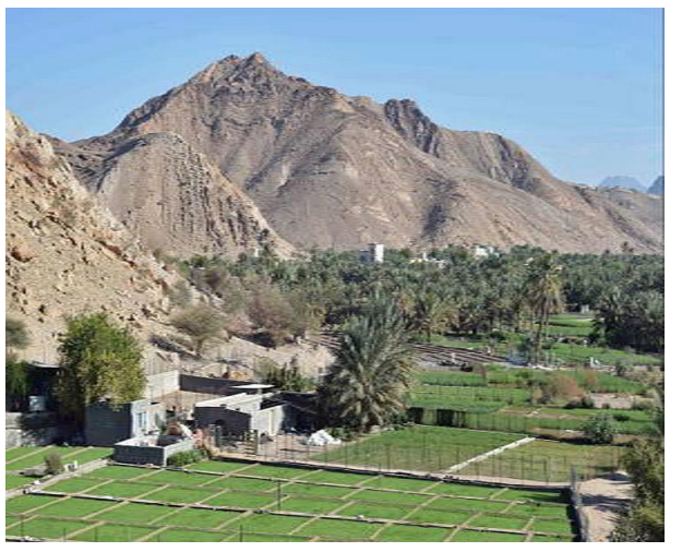
Samples for palaeoenvironmental analyses were collected from a topographic depression (Lat/Long N25°08’20.83” E055°51’44.64”) to the west of Mleiha, close to Jebel Faya and Jebel Mleiha, which is filled with fluvial, lacustrine and aeolian sediments. These sediments were identified as part of the University of Tübingen-Sharjah archaeological research project led by Prof Hans-Peter Uerpmann and Dr Sabah Jasim, and provide an extensive chronological sequence spanning the mid to late Holocene period. Natural sediment exposures were extended using test pits. In addition, quarrying for sand in the area for construction purposes has led to several sediment exposures through the dune-sequence overlying the lacustrine silts and fluvial gravels which extend laterally beneath the dunes. Initial findings from three test sections (MLQ, MLP and MLL) are reported here. Several other sections are currently being studied and details will be reported in full at a later date.
Seventeen samples were dated using Optical Stimulated Luminescence (OSL) dating from four key sediment sections (Table 1) Preliminary results suggest the following sequence of events is recorded within the examined sediments. A series of basal gravels were noted in two of the sediment test pits (MLP and MLL). It should be noted that these gravels were not bottomed. The coarse grained layers in the lower sections of these three profiles show clear features of fluvial deposition via episodic sheet floods or shallow water channels from the Hajar Mountains transporting the predominantly ophiolite-rich material. An OSL age of 6.55±0.62 ka (4550±620 BC) was determined towards the base of test pit MLP. During the Neolithic, wetter conditions than today have been recognised across south-eastern Arabia. During this period monsoonal rainfall led to the development of lakes and active channel flow in wadis across the region with evidence for grassland covering the dunes of the Rub al-Khali in the region between 8.50 – 6.00 ka (6500-4000 BC) (Parker et al., 2006; Parker and Goudie, 2008). Evidence for Neolithic occupation of the landscape in the Mleiha region has been identified from a number of important stratified and dated archaeological sites found along the eastern flanks of Jebel Buhais (Uerpmann et al., 2006) and Jebel Faya, (Kutterer and de Beauclair, 2008; Uerpmann et al., 2013).
Aeolian cream-coloured sands, dating to the Bronze Age, 4.30-4.10 ka, were found sealing overlying the gravels in three of the test pit sections (MLQ, MLP, MLL). These dates correspond to a regionally identified phase of aridity, which has been interpreted from sand infilling the desiccated lake basin at Awafi, Ra’s al-Khaimah (Parker et al., 2006) and a major phase of dune accumulation near Al Ain, where 7 m of emplacement occurred between 4.30 and 4.00 ka (2300-2000 BC) (Atkinson et al., 2012). Three phases of ponded lacustrine sedimentation were identified at Mleiha and dated to ~ 4.00 ka (2000 BC), 1.80 ka (AD 200) and 0.17 ka (AD 1830) respectively. In test pit MLP the uppermost lacustrine layer contained Late Pre-Islamic Mleiha period pottery. OSL ages for lacustrine silts from the sections broadly fit into the Late Iron Age and PIR/pre-Islamic recent/ Late Pre-Islamic periods. No other lake sites have been identified from elsewhere in the region dating to this period. This provides the first terrestrial palaeoenvironmental record from SE Arabia spanning this period. These lacustrine silts extend laterally westwards and are overlain by red aeolian dunes up to 8 m high. These dunes show rapid dune encroachment over the site during the last 1500 years.
At Mleiha a major inland settlement was present during the pre-Islamic recent period. Between the 3rd century BC and the 4th century AD two substantial mud-brick forts and numerous houses and burials are known to have existed (Benoist et al., 2003). Kennet (2005) suggests that by the 3rd century AD occupation had declined and that by the 5th century the site was deserted altogether. In addition to the decline of settlements across SE Arabia at this time, Kennet suggests that there is evidence for a wider economic decline during this period. The cause for this decline is uncertain. However, the pattern of reduced settlement that began after the first or second centuries AD and continued until the seventh century AD may have been linked to the severe droughts identified by Fleitmann et al. (2009) from a speleothem record from Hoti Cave in the Hajar Mountains of Oman. Of note is a decline in rainfall between AD 500 and AD 1,000 with an intense drought occurring around AD 530 (Fleitmann et al., 2009). During this period, a series of profound societal changes have been suggested from Arabia which coincide with the transition between the Late Pre-Islamic and Islamic periods within the archaeological record. The development of lacustrine sediments at Mleiha may help explain the inland expansion of Late Pre-Islamic period influence due to increased water availability.
The decline of the Late Pre-Islamic sites at Mleiha may be linked to increased aridity and major drought, as identified in the Hoti Cave speleothem record, which led to major changes in water availability, desiccation of the water body and the onset of major dune reactivation and migration across the Mleiha landscape. The ongoing work at Mleiha is crucial for understanding the climate and landscape record through time and how this may have impacted human occupation as identified in the archaeological record.
Acknowledgements
Funding to support the dose rate calculations for the OSL dating was kindly provided the Emirates Natural History Group (ENHG) and the British Foundation for the Study of Arabia (BFSA).
References
Armitage, S.J., Jasim, S.A., Marks, A.E., Parker, A.G., Usik, V.I. and Uerpmann, H-P. 2011. The Southern Route “out of Africa”: Evidence for an Early Expansion of Modern Humans into Arabia. Science 331: 453-456.
Atkinson, O. A., Thomas, D. S., Goudie, A. S. and Parker, A. G. 2012). Holocene development of multiple dune generations in the northeast Rub’al-Khali, United Arab Emirates. The Holocene 22: 179-189.
Benoist, A., Mouton, M. and Schiettecatte, J. 2003. The artefacts from the fort at Mleiha: distribution, origins, trade and dating. Proceedings of the Seminar for Arabian Studies 33: 59-76.
Farrant, A., Arkley, S. L. B., Ellison, R. A., Styles, M. T. and Phillips, E. R. (2006). Geology of the Al Dhaid 1: 100 000 Map Sheet, 100-2. United Arab Emirates, 1-61.
Fleitmann, D., Burns, S. J., Mangini, A., Mudelsee, M., Kramers, J., Villa, I., Neff, U., Al-Subbarye, A.A., Buettnera, A., Hipplera, D. and Matter, A. 2007. Holocene ITCZ and Indian monsoon dynamics recorded in stalagmites from Oman and Yemen (Socotra). Quaternary Science Reviews 26: 170-188.
Fleitmann, D., Mudelsee, M., Bradley, R. S., Pickering, R., Kramers, J., Burns, S. J., Mangini, A. and Matter, A. 2009. Megadroughts at the dawn of Islam recorded in a 2600-year long stalagmite from northern Oman, Geophysical Research Abstracts 11: EGU2009-8174-1
Kennet, D. 2005. On the eve of Islam: archaeological evidence from Eastern Arabia. Antiquity 79: 107-118.
Kutterer, A.U. and de Beauclair, R. (2008). FAY-NE15 Another Neolithic graveyard in the central region of the Sharjah Emirate? Arabian Archaeology and Epigraphy 19: 134-143.
Mouton, M. 1999. Mleiha I: Environnement, stratégies de subsistance et artisannats [Mleiha I, environment, subsistence strategies and crafts]. Travaux de la Maison de l’Orient Méditerranéen, 29, 292 pp.
Parker, A.G. and Goudie, A.S 2008. Geomorphological and palaeoenvironmental investigations in the southeastern Arabian Gulf region and their implication for the archaeology of the region. Geomorphology 101: 248-470.
Parker, A.G., Goudie, A.S., Stokes, S., White, K., Hodson, M.J., Manning, M. and Kennet, D. 2006. A record of Holocene Climate Change from lake geochemical analyses in southeastern Arabia. Quaternary Research 66: 465-476.
Parton, A., Farrant, A. R., Leng, M. J., Schwenninger, J. L., Rose, J. I., Uerpmann, H-P. and Parker, A. G. 2013. An early MIS 3 pluvial phase in Southeast Arabia: Climatic and archaeological implications. Quaternary International 300: 62-74.
Preston, G. W., Parker, A. G., Walkington, H., Leng, M. J., and Hodson, M. J. 2012. From nomadic herder-hunters to sedentary farmers: the relationship between climate change and ancient subsistence strategies in south-eastern Arabia. Journal of Arid Environments 86: 122-130.
Uerpmann, H-P., Uerpmann, M. & Sabah, S.A. 2006. The Archaeology of Jebel al-Buhais. Volume 1: Funeral Monuments and Human Remains from Jebel al-Buhais. Kerns Verlag, Tübingen.
Uerpmann, H-P., Uerpmann, M., Kutterer, A. and Jasim, S.A. 2013. The Neolithic period in the Central Region of the Emirate of Sharjah (UAE). Arabian Archaeology and Epigraphy 24: 102–108.


