SUMMARY At the crossroads between Africa and Eurasia, Arabia is crucial to understanding global Pleistocene hominin dispersals (Groucutt et al., 2015), yet its rich Early Stone Age (ESA) record is patchily understood. Detailed investigation, of artefact-rich ESA localities, with associated palaeoenvironmental archives, are sorely needed to assess dispersal conditions and timings (Petraglia 2003). Discovered in 2015 Wadi Dabsa, Asir Province, southwestern Saudi Arabia, in the volcanic fields of the Harrat al Birk, yielded >900 ESA and MSA artefacts associated with tufa carbonate deposits (Foulds et al., In Press; Inglis et al., 2015). Yet while preliminary investigations proved the significant potential of Wadi Dabsa to inform on early hominin activity, in its environmental context, there remained a number of key unanswered questions: How are artefacts distributed across the basin? What can this tell us about early hominin behaviour? What is the relationship between the tufa and artefacts? When did the tufa form and what can it tell us about Arabian palaeoenvironments?
The project combined remote sensing, excavation, and archaeological and geomorphological survey to capitalise upon a rare opportunity to examine ESA, and MSA, behaviour in an environmental/landscape context, and its implications for hominin dispersals out of Africa. A multi-scalar geoarchaeological approach to understanding the locality, its landscape and the archaeology was undertaken, working in from the wider landscape to the area where the highest number of basalt artefacts had been recorded in 2015 (Inglis et al., 2015). Fieldwork, undertaken over three weeks in January/February 2017 at Wadi Dabsa followed by a week of post-excavation artefact analysis in Asir Museum, Abha, achieved the stated objectives and provided a wealth of information on the Palaeolithic artefacts and their geomorphological and geological setting that will greatly add to our understanding of Palaeolithic landscapes in Saudi Arabia (Inglis et al., 2017).
Objectives achieved:
- Definition of landscape units within the Wadi Dabsa basin using remote sensing and satellite data, groundtruthed by field observations, enabling the development of a stratigraphic framework for landscape evolution and artefact visibility.
- Geomorphological survey, with specific focus on the tufa deposition and basalt, allowed development of hypotheses regarding the landscape setting of the main concentration of artefacts first observed in 2015 (Locality L0106/L0130).
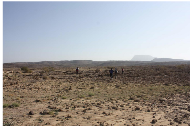
- Collection of 1938 Palaeolithic artefacts from a 20 x 50 m extension of L0106, with a further 399 lithic artefacts recorded in situ across L0130 (50 x 60m), comprised a recorded assemblage over the two seasons of 3226 artefacts, many with ESA or MSA affinities, and one of the richest Palaeolithic assemblages recorded to date in SW Saudi Arabia.
- Detailed landform and surface mapping of the L0106/L0130 artefact collection grids at L0130 furthering the understanding of artefact distribution and geomorphological controls acting upon it.
- Comprehensive post-excavation analysis of the artefacts collected from L0106, coupled with in situ recording of the L0130 artefacts, allowed consideration of the assemblage in relation to those from neighbouring regions.
- Excavations of two test pits containing artefacts in a unit overlying the tufa, and the discovery of a tufa-encased handaxe indicated complex artefact-tufa relationships, perhaps resulting from the extended period of time spanned by the activity at the site and/or multiple phases of tufa deposition.
- Collection of samples for 234U– 230Th (tufa) and 39Ar/40Ar (basalt lava flows) to provide a future chronological framework for landscape development the archaeology within it. The tufa samples will also provide, through isotopic analyses, palaeoenvironmental information.
Key Results
Landscape Evolution
Fieldwork at Wadi Dabsa clarified the preliminary desktop mapping of landscape units using remote sensing data, and provided a solid framework to begin to interpret the artefacts recorded from the basin within a dynamic landscape context. In particular, groundtruthing of the landscape stratigraphy and the relationship of the tufa to the various basalt flows identified remotely appears to have confirmed that the basin was largely formed prior to tufa deposition, and that tufa was forming in, and filling, a basin whose underlying morphology was controlled by the basalt flows. It is likely, however, that there was more than one phase of tufa deposition in the basin, and that deposition of tufa and basalt may well have overlapped. Future absolute dating of the tufa and basalt flows using the samples collected in 2017 should test this hypothesis, and, as well as providing a robust landscape context for the archaeological record within the basin, will also address wider debates around regional palaeoclimates and the timing of volcanism in the Red Sea region.
Observations from the 2017 field season have revealed complex relationships between the artefacts and tufa formation. A tufa-coated handaxe discovered in Grid L0130 showed that a period of tufa deposition occurred after manufacture and deposition of the artefact. Yet in the test pits excavated in Grid L0106, artefacts lie within a sediment layer directly overlying the tufa, suggesting that deposition of the artefacts post-dates the formation of the tufa. Such variability in tufa-artefact relationships is, however, unsurprising given the potentially long time span of activity represented by the presence of ESA, MSA and LSA artefacts at the site, and the evidence we have so far for complexity of tufa formation within the basin. The lithic artefact assemblages and the tufa are probably both the product of multiple phases of human activity and tufa deposition across the basin, phases that potentially occurred over extended periods of time, indicating that the basin itself was a consistent focus of activity throughout the Palaeolithic.
Geomorphological mapping and observations of the artefact distributions across the L0106/L0130 grids at the metre-scale has allowed the examination of whether the artefact distribution at the grid scale is influenced by geomorphic processes that control the preservation, exposure and visibility of artefacts, or by hominin activity. It appears that the former is the case at this locality: there are low counts of artefacts on the landform units most likely to exhibit surface conditions that inhibit the visibility of artefacts, and the richest grid squares in terms of artefact number were recorded within the Crest landform unit, the unit which preserves the greatest extent of the artefact–bearing sediment layer, and which is being eroded and deflated, continually exposing further artefacts. These observations highlight the complex interplay of the processes that preserve, expose, and render artefacts visible to survey, and which need to be understood at each scale of observation whilst undertaking spatial analyses of the archaeological record of any time period.
Lithic Analyses
The assemblage from the Wadi Dabsa comprises a mixture of ESA/Acheulean pieces including a collection of bifaces, large cutting tools and cleavers, as well as an extensive range of MSA/Middle Palaeolithic pieces including both an extensive collection of manufacturing debitage as well as retouched pieces. All of these materials appear to be made on locally available volcanic rocks, that can be accessed, at present, both at the site itself and throughout the Wadi Dabsa basin. In a similar fashion to sites examined elsewhere in southwestern Saudi Arabia, the abundance of locally available raw materials would appear to have created a situation in which hominins did not need to maximise the efficiency with which they used materials. As a result, many of the pieces are simply retouched with just the working tips of bifaces, for example, finely retouched to produce rectilinear edges and the buts remaining often either cortical or very simply retouched. There are a few examples of lithic materials that are not obviously occurring in the local basin (including quartz, chert and indurated shale) and these pieces also show greater preparation and retouch. It seems likely at the moment that these pieces represent the discard of later, post MSA hominins. Likewise, there are a few examples of tool types (endscrapers and burins) that are normally associated with Upper Palaeolithic assemblages in Europe, although such tools have been found in MSA assemblages in Africa.
Beyond the Wadi Dabsa basin, the lithic assemblage itself contains pieces that are similar to examples found during the course of the fieldwork by the UK-Saudi team since 2013 (Bailey et al., 2015; Inglis et al., 2014; Sinclair et al., In Review), but the quantity and, specifically, the quality of the technological information present at Wadi Dabsa is more extensive and complete in sequence than at any other site located so far by the team. The variability in evident skill among the examples of prepared cores also suggests that the assemblage represents a cross- section of ages and experience in lithic manufacture; this is unique to this site, and will be a major focus of investigation and publication over the coming months.
Conclusions and Future Work
The 2017 field season, whilst very successful in achieving its stated objectives, has only just begun to realise the potential of the Wadi Dabsa basin for informing on ESA and MSA hominin behaviour. The geomorphological work at the site, particularly the mapping and sampling of the tufa, has proven its complexity, and indicated that there is much more that can be done in terms of survey to understand the geomorphological controls and landscape context of the rich archaeological record of this region. Future work in the Dabsa basin must focus on two main issues. The first is the further understanding of the timing and conditions of tufa deposition within the basin. Detailed mapping using high-resolution remote sensing and field observations, coupled with detailed stratigraphic and microscopic analysis of the tufa facies should be used to unravel the nature and sequence of the depositional environments. This stratigraphic framework, coupled with future absolute dating and isotopic analyses, would then be used to target further palaeoenvironmental investigation, and chronological constraint of, the tufa deposition in the basin.
The second area is the expansion of the surveyed areas to further understand the L0106/130 assemblage in the context of the artefact distributions across the basin – is the density of artefacts at this location unusual, and if so, why might there be a concentration of artefacts deposited or preserved here? The 2015 transects, considered along with the low density of artefacts observed during geomorphological investigations across the basin, indicate that the number of artefacts at L0106/130 is unusually high. Further archaeological investigation of similar geomorphological settings to this assemblage around the basin, targeted through detailed geomorphological and tufa mapping, however, should be carried out to confirm that it represents an unusually dense concentration of artefacts, in order to understand the potential for the assemblage to inform on human activity at this location.
Acknowledgements
We thank HRH Prince Sultan bin Salman bin Abdul Aziz, President of the Saudi Commission for Tourism and National Heritage (SCTH), KSA, Professor Ali Al-Ghabban, Consultant to the President, Dr Hussein Abu Al Hassan, Vice President for Antiquities and Museums, and Dr Abdullah Al Saud, Director General, Dr Abdullah Al Zahrani, General Manager of Research and Archaeological Studies for granting fieldwork permission and for their support of our work in Saudi Arabia. Grateful thanks are also extended to Mr Saeed Al Karni, Director of Antiquities in Asir and his staff at the Abha Regional Museum. Mr DhaifAllah bin Tha’ar Al-Otaibi, National Museum lead the Saudi team in the field.
The 2017 fieldwork was funded by generous grants from the British Foundation for the Study of Arabia, the British Academy (Arthur Reckitt Fund), and the Gerald Averay Wainwright Fund for Near Eastern Archaeology at the University of Oxford. RHI also gratefully acknowledges funding from the European Union’s Horizon 2020 research and innovation programme under the Marie Skłodowska-Curie grant agreement No. 660343, “SURFACE: Human-LandscapeInteractions and Global Dispersals: The Surface Record of Palaeolithic Arabia”.
Further updates on the project as well as reports from the 2017 field season, can be found at: https://surfaceproject.wordpress.com/
References
Bailey, G.N., Devès, M.H., Inglis, R.H., Meredith-Williams, M.G., Momber, G., Sakellariou, D., Sinclair, A., Rousakis, G., Al Ghamdi, S., Alsharekh, A. (2015). Blue Arabia: Palaeolithic and underwater survey in SW Saudi Arabia and the role of coasts in Pleistocene dispersals, Quaternary International, 382, 42–57.
Foulds, F., Shuttleworth, A., Sinclair, A., Inglis, R., Alsharekh, A., Al Ghamdi, S., Bailey, G.N. (In Press). A Preliminary Report of a Large Handaxe from Wadi Dabsa, Saudi Arabia: Implications for Hominin Adaptations to the Arabian Peninsula, Antiquity.
Groucutt, H.S., Petraglia, M.D., Bailey, G.N., Scerri, E.M., Parton, A., Clark-Balzan, L., Jennings, R.P., Lewis, L., Blinkhorn, J., Drake, N.A., Breeze, P.S., Inglis, R.H., Deves, M.H., MeredithWilliams, M.G., Boivin, N., Thomas, M.G., Scally, A. (2015). Rethinking the dispersal of Homo sapiens out of Africa. Evolutionary Anthropology, 24: 149–164.
Inglis, R.H., Foulds, F., Shuttleworth, A., Alsharekh, A.M., Al Ghamdi, S., Sinclair, A.G., Bailey, G.N. (2015). The Palaeolithic Occupation of the Harrat Al Birk: Preliminary Report on the 2015 Fieldwork in Asir Province, Southwest Saudi Arabia. Report to the Saudi Comission for Tourism and Antiquities. Accessible at: http://eprints.whiterose.ac.uk/84382/
Inglis R.H., Sinclair, A.G.M., Alsharekh, A.M., Barfod, D.N., Chang, H.-C., Fanning, P.C., Al Othaibi, D.T., Robson, H.K., Shuttleworth, A., Stone, A., Bailey, G.N. (2017). Preliminary report on UK-Saudi 2017 fieldwork at Wadi Dabsa, Asir Province, Saudi Arabia. Accessible at: http://eprints.whiterose.ac.uk/119267/
Petraglia, M.D. (2003). The Lower Palaeolithic of Arabian Peninsula: occupations, adaptations, and dispersals. Journal of World Prehistory, 17(2): 141–179.
Sinclair, A., Inglis, R.H., Shuttleworth, A., Foulds, F., Alsharekh, A., (In Review). Landscape Archaeology, Palaeolithic Survey and Coastal Change along the Southern Red Sea of Saudi Arabia. In: Rasul N, Stewart IS (eds) The Red Sea II. Springer, Amsterdam.

Fig. 1: Main image: Satellite image of the Wadi Iddayyah region showing the location of the study sites, AQP, IDD1 and IDD2, and Jebel Faya (Copernicus Sentinel-2 data 2017). Inset image: Satellite image of the northern UAE showing the location of Wadi Iddayyah (Esri Basemap 2018).
The 4.80 sedimentary sequence identified at AQP (N25°2.569′ E055°48.166′), which is located at the junction of Wadi Iddayyah and Wadi Baraq, is divided into three main stratigraphic units (Fig. 2). The basal unit (~0.40 m) is comprised of aeolian sands which are OSL dated to 69.07±4.93 ka. This age falls within MIS 4 (~75 – 60 ka), a period characterised by a general lack of dated terrestrial records (Parton et al., 2015b). Dune accumulation is recorded at Liwa, UAE (Stokes and Bray, 2005) and Wahiba, Oman (Preusser, 2009) during MIS 4, whilst at al-Sibetah, UAE the accumulation of aeolian sands (~2.00 m) is dated to 73.0±7.4 ka (Parton et al., 2015a). The deposition of aeolian sands at the base of the AQP sequence is consistent with the above evidence and supports to general consensus that hyper-arid conditions prevailed throughout much of MIS 4. The basal sands are overlain by ~4.00 m of (a) fluvially-deposited silts and planar-bedded sands interspersed with (b) minor carbonate-rich sand deposits containing desiccation polygon mud curls. Four OSL ages were obtained from this unit (from the base of the unit upwards): 38.40±1.91 ka, 36.60±1.68 ka, 35.80±2.23 ka and 30.49±1.71 ka. Whilst the four ages are in stratigraphic order (i.e. oldest at the base, youngest at the top), the error ranges of the basal three ages statistically overlap, potentially suggesting rapid deposition over a very short period. The sedimentological and geochemical data suggest that these deposits reflect repeated phases of channel flow which led to the reworking of aeolian sands by fluvial processes, with the deposits fining upwards suggesting a gradual waning of stream flow and desiccation. A broadly similar pattern of episodic stream flow is described by Parton et al. (2013) at a site approximately 1 km from AQP, where phases of overbank flooding/lake formation were dated between 61 – 58 ka. Evidence of early MIS 3 (~60.0 – 50.0 ka) drainage activation is also reported from central and south-eastern Arabia (Blechschmidt et al., 2009; McLaren et al., 2009; Parton et al., 2013, 2015a; Hoffmann et al., 2015). The OSL ages from AQP are therefore much later than most reported to date, falling towards the end of MIS 3 (~38.0 – 30.0 ka). Nonetheless it is noted that this period coincides with another insolation maxima (Berger and Loutre, 1991), potentially suggesting that strengthened monsoon rainfall was sufficient to trigger drainage activation and repeated phases of channel flow late in MIS 3. The upper ~1.20 m of the AQP section is comprised of moderately rounded limestone clasts within a fine-grained sand matrix and is undated. The origin and interpretation of this unit is still under investigation.

The 3.87 m sedimentary sequence at Wadi Iddayyah 1 (IDD1) (N25°6.135′ E 55°47.820′), which is located on the edge of the main wadi channel, comprises five main stratigraphic units (Fig. 3). The basal unit (~0.70 m) is comprised of aeolian sands which are OSL dated to 90.93±7.95 ka. This age falls within MIS 5.2 (~105 – 85 ka), a period of which relatively little is known about the prevailing climatic conditions (Parton et al. 2015b). In contrast to the distinct humid phases recorded during MIS 5.5, 5.3 and 5.1, the lack of speleothem growth during MIS 5.2 (Burns et al., 1998; Fleitmann et al., 2003) suggests a shift to more arid conditions. Evidence of aeolian activity is reported in Al Ain, UAE (Atkinson et al., 2013), Wahiba, Oman (Preusser, 2009) and Khujaymah, Saudi Arabia (Rosenberg et al., 2011). A reduction in monsoon rainfall/suppressed Inter Tropical Convergence Zone (ITCZ) over Arabia has been proposed at this time (Parton et al., 2015b) and it is noted that the period broadly corresponds to an insolation minimum (Berger and Loutre, 1991). The basal sands are overlain by a series of planar-bedded and cross-bedded sand deposits, the uppermost of which is dated to 33.30±3.18 ka, which are suggested to reflect the reworking of aeolian sands by late MIS 3 fluvial activity.

Wadi Iddayyah 2 (IDD2) (N25°14.039′ E55°40.343′), is a series of fluvial terraces which run along the right-hand side of a small channel which has punctuated through the dunes away from the main wadi channel (Fig. 4). At terrace A (0.45 m), the uppermost terrace, a ~0.10 m unit of silts is interspersed between aeolian sands indicating the development of a very low energy, fluvial environment. An OSL age of 15.42±0.91 ka was derived from the aeolian sands immediately beneath the silts. At terrace B (1.10 m) the basal unit comprises planarbedded, very fine sands which have a much higher silt component (~20%) than the upper units. An OSL age of 17.46±1.05 ka was derived from this unit. At terrace C two silt units are separated by aeolian sands dated to 16.10±0.91 ka. The uppermost sand unit at the site is OSL dated to 16.66±0.97 ka. The error ranges of the two ages statistically overlap potentially suggesting rapid, almost simultaneous, deposition. The accumulation of several distinct silt units at IDD2 implies that there was sufficient rainfall to generate low energy channel flow or standing water during MIS 2 (~30.0 – 11.50 ka). This is consistent with evidence from an increasing number of lake sites (Parker, 2009; Parker et al. unpubl.), travertines (Clark and Fontes, 1990), sabkha deposits (Wood and Imes, 1995) and speleothem records (Fleitmann et al., 2004) which highlight the probable occurrence of short-lived, wetter conditions during the otherwise hyper-arid conditions which are thought to have prevailed throughout much of MIS 2 (Leighton et al., 2014).
The deposition of aeolian sands at the base of the IDD1 and AQP sequences appears to postdate the oldest known occupation phase (assemblage C) at Jebel Faya which yielded OSL ages of 127±16, 123±10 and 94.8±13 ka (Armitage et al., 2011) although it is noted that the latter age does potentially fall within MIS 5.2. The next dated occupation phase at the site (assemblage A) yielded ages of 38.6±3.1 and 40.2±3.0 ka, thus falling in MIS 3 (~60 – 30 ka), and is separated from assemblages C and B by undated sterile sediments, possibly reflecting a break in occupation at the site between MIS 5.2 and MIS 3. The MIS 3 occupation layer at Jebel Faya is separated from a deposit containing early Holocene lithics (Fasad Points) by ~0.40 m of sterile sands which yielded ages of 38.6±3.2 and 34.1±2.8 ka (Armitage et al., 2011). These sterile sands are therefore broadly contemporaneous with the deposition of fluvial sediments at AQP, highlighting the complex interaction of aeolian and fluvial processes in the region. The implications of these findings in terms of human occupation and movement across the landscape is the focus of the Co-Is current PhD research and will be discussed in future papers.

Acknowledgments:
The OSL dating and laboratory analyses were kindly supported by the International Association for the Study of Arabia (IASA). We would like to thank the Department of Culture and Information of the Emirate of Sharjah and the Directorate of Antiquities, for permission to work in the region, and especially Knut Bretzke for his support during the fieldwork. We are very grateful to Frank Preusser of the Sedimentary Geology and Quaternary Research group at the University of Freiburg and his team, including Daniela Mueller, Johannes Miocic and Alexander Fuelling, for their advice in the field and invaluable support during the OSL dating work. Finally, we are grateful to Adrian Parker and Ash Parton for their constructive comments throughout the course of this project.
References:
Armitage, S. J., Jasim, S. A., Marks, A. E., Parker, A. G., Usik, V. I., Uerpmann, H. P. (2011) The southern route “out of Africa”: evidence for an early expansion of modern humans into Arabia. Science 331, 453 – 456.
Atkinson, O. A. C., Thomas, D. S. G., Parker, A. G. and Goudie, A. S. (2013) Late Quaternary humidity and aridity dynamics in the northeast Rub’ al-Khali, United Arab Emirates: Implications for early human dispersal and occupation of eastern Arabia, Quaternary International, 300, 292 – 301.
Berger, A., Loutre, M.F. (1991) Insolation values for the climate of the last 10 million years. Quaternary Science Reviews 10 (4), 297 – 317.
Blechschmidt, I., Matter, A., Preusser, F., Rieke-Zapp, D. (2009) Monsoon triggered formation of Quaternary alluvial megafans in the interior of Oman. Geomorphology 110, 128 – 139.
Burns, S., Matter, A., Frank, N., Mangini, A. (1998) Speleothem-based paleoclimate record from northern Oman. Geology 26 (6), 499 – 502.
Clark, I., Fontes, J.C. (1990) Paleoclimatic reconstruction of northern Oman based on carbonates from hyperalkaline groundwaters. Quaternary Research 33, 320 – 36.
Fleitmann, D., Burns, S.J., Neff, U., Mangini, A., Matter, A. (2003) Changing moisture sources over the last 330,000 years in Northern Oman from fluid-inclusion evidence in speleothems. Quaternary Research 60 (2), 223 – 232.
Fleitmann, D., Matter, A., Pint, J.J., Al-Shanti, M.A. (2004) The Speleothem Record of Climate in Saudi Arabia. Open-File Report, Saudi Geological Survey, Jeddah, Kingdom of Saudi Arabia.
Groucutt, H.S., Petraglia, M.D., Bailey, G., Scerri, E.M.L., Parton, A., Clark-Balzan, L., Jennings, R.P., Lewis, L., Blinkhorn, J., Drake, N.A., Breeze, P.S., Inglis, R.H., Deves, M.H., Meredith-Williams, M., Boivin, N., Thomas, M.G., Scally, A. (2015) Rethinking the dispersal of Homo sapiens out of Africa. Evolutionary Anthropology 24 (4), 149 – 164. Hoffmann, G., Rupprechter, M., Rahn, M., Preusser, F. (2015) Fluvio-lacustrine deposits reveal precipitation pattern in SE Arabia during early MIS 3. Quaternary International 382, 145 – 153.
Leighton, C.L., Bailey, R.M., Thomas, D.S.G. (2014) Interpreting and modelling late Quaternary dune accumulation in the southern Arabian Peninsula. Quaternary Science Reviews 102, 1 – 13.
McLaren, S.J., Al-Juaidi, F., Bateman, M.D., Millington, A.C. (2008) First evidence for episodic flooding events in the arid interior of central Saudi Arabia over the last 60 ka. Journal of Quaternary Science 24, 198 – 207.
Parker, A.G. (2009) Pleistocene climate change in Arabia: Developing a framework for hominin dispersal over the last 350 ka. In: Petraglia, M.D., and Rose, J. (Eds.), The evolution of human populations in Arabia: Paleoenvironments, prehistory and genetics. Springer, Netherlands, 39 – 49.
Parker, A.G., Preston, G.W., Borgi,F. (Unpublished) Umm al-Qawain: Geomorphology and geoarchaeology report March 2014.
Parton, A., Farrant, A.R., Leng, M.J., Schwenninger, J.-L., Rose, J.I., Uerpmann, H.-P., Parker, A.G. (2013) An early MIS 3 pluvial phase in Southeast Arabia: Climatic and archaeological implications. Quaternary International 300, 62 – 74.
Parton, A., Farrant, A.R., Leng, M.J., Telfer, M.W., Groucutt, H.S., Petraglia, M.D., Parker, A.G. (2015a) Alluvial fan records from southeast Arabia reveal multiple windows for human dispersal, Geology 43 (4), 295 – 298.
Parton, A., White, T.S., Parker, A.G., Breeze, P.S., Jennings, R., Groucutt, H.S., Petraglia, M.D. (2015b) Orbital-scale climate variability in Arabia as a potential motor for human dispersals. Quaternary International 382, 82 – 97.
Preusser, F. (2009) Chronology of the impact of Quaternary climate change on continental environments in the Arabian Peninsula. Comptes Rendus Geoscience 341, 621 – 632.
Rosenberg, T.M., Preusser, F., Fleitmann D., Schwalb, A., Penkman., K., Schmid, T.W., AlShanti, M.A., Kadi, K., Matter, A. (2011) Humid periods in southern Arabia: Windows of opportunity for modern human dispersal. Geology 39 (12), 1115 – 1118.
Stokes, S., Bray, H.E. (2005) Late Pleistocene eolian history of the Liwa region, Arabian Peninsula. Geological Society of America Bulletin 117, 1466 – 1480.
Wood, W.W., Imes, J.L. (1995) How wet is wet? Precipitation constraints on late Quaternary climate in the southern Arabian peninsula. Journal of Hydrology 164, 263 – 268.


