The Mapping Magan archaeological survey is working to understand how prehistoric archaeological remains in the area surrounding the UNESCO World Heritage Site of Bat, Oman can be used to reconstruct the political and social landscape of the early Bronze Age in the region. This research, the basis of my PhD dissertation, is combining artifactual and spatial analyses to better understand relationships between different settlements and the thousands of stone tombs that dot the landscape surrounding Bat. Rather than focusing on southeastern Arabia’s connections to external polities, the project is taking a localized approach to understand the complex networks of interaction present within the bounds of a small area.

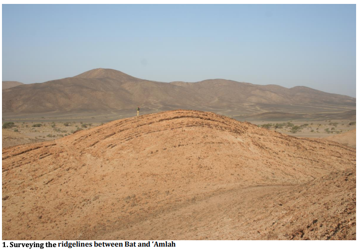
Thanks to a generous grant from the BFSA and other sponsors, the project recently completed its first field season. Over the course of Spring 2017, we systematically Eli Dollarhide BFSA Results Summary 2 surveyed a 130 km2 area between the ancient settlements of Bat and ‘Amlah in central Oman, looking for archaeological remains. The boundaries of our research zone were selected to adjoin previously examined areas in the Bat region (Cable 2012; Kondo et al 2016; Thornton et al 2016), building a continuous surveyed area across the region’s Bronze Age settlements.
Before the start of our on-the-ground fieldwork, a remote reconnaissance program of the survey area was conducted utilizing satellite imagery from the DigitalGlobe Foundation. This ultra high-resolution (sub-one meter) imagery made it possible to identify some Bronze Age features, especially tombs, remotely. Knowing these locations allowed us to focus our limited time in the field on areas with high concentrations of archaeological remains.
In total, over 480 previously unrecorded archaeological sites were identified in our survey. Though the focus of our research program is on the Bronze Age, the fieldwork was diachronic, recording all archaeological features we encountered regardless of time period. Several of our most exciting finds in fact came from the Iron Age. These included a large conglomeration of Iron Age tombs and field systems near the modern settlement at ‘Ablah. Several of the tombs at ‘Ablah were re-used Bronze Age constructions, an occurrence well documented in other parts of Oman (e.g. Williams and Gregoricka 2013).

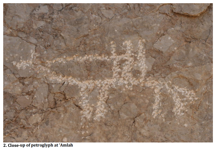
We also documented hundreds of petroglyphs spread over five massive wadi boulders at nearby ‘Amlah. Several different designs were evident on the boulders, Eli Dollarhide BFSA Results Summary 3 including humans on quadrupeds; standing figures with weaponry; and a variety of animal shapes. All were impressed on the rocks’ surfaces with percussion, in a form of prehistoric pointillism. The presence of domesticated horses in the petroglyphs and their proximity to a nearby Iron Age cemetery (Yule 1999) suggests, at the earliest, a Late Iron Age date for their creation.
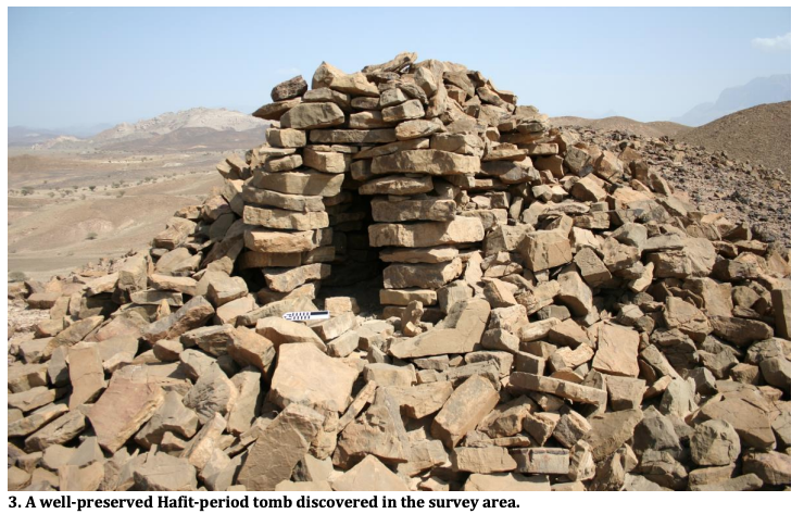
Three hundred thirty-one tombs were discovered and recorded in the survey area. Nearly half of these (141) were identified as dating to the Hafit period. Several particularly well-preserved examples of Hafit tombs were found 9km southeast of Bat, overlooking an area of modern cultivation (see attached image). All were constructed with locally obtained blocks of grey-brown schist, were singlechambered, ranged between 4-9m in diameter, and were typically found on highelevation ridgelines.

Nine Umm an-Nar period tombs were identified, in various states of preservation. Several examples near ‘Amlah had been subjected to severe stone-robbing. All were located on flat plains and built with diagnostic white limestone ashlars.
Additionally, this spring’s survey operations discovered a new series of structures between Bat and ‘Amlah, nearly 10km south of the UNESCO Zone. Five rectangular structures were recorded with GPS and drone-captured aerial photography, all built along the edges of an old alluvial fan. Umm an-Nar ceramics collected from within each of the structures suggest a Bronze Age occupation of the buildings, though the environmental setting differentiates this cluster from Bat’s other environs. 3. A well-preserved Hafit-period tomb discovered in the survey area.
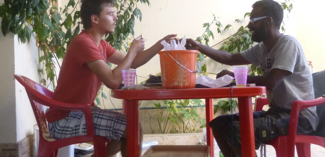
The comparative petrographic and stylistic analyses of the ceramics we collected and exported is ongoing—the results of which will help build a webbed model of interaction for the Bat region. The initial results of a GIS analysis of the Bronze Age features recorded in our survey indicates that Hafit tombs strongly cluster around individual settlements and confirms the presence of several areas devoid of cultural materials. The sheer quantity of tombs surrounding Bat highlights its significance in the earlier phases of the Bronze Age and the density of Iron Age features around ‘Ablah and ‘Amlah help reconstruct a temporally dynamic landscape of the region.
Many new construction projects threaten archaeological resources across central Oman. By collaborating with the Ministry of Heritage and Culture, many of the sites recorded in this past season’s survey area are now included in nationally-protected heritage zones, safeguarding them for the future.
These preliminary findings have been presented at the International Congress of Young Archaeologists at Tehran University and in the archaeology of Arabia session at the 2017 American Schools of Oriental Research (ASOR) meeting.
Acknowledgements:
This research was sponsored by the Oman Ministry of Heritage and Culture and owes a particular debt of gratitude to Mr. Sultan al-Bakri, Mr. Khamis al-Asmi, and Mr. Suleiman al-Jabri. This winter’s field team included the invaluable assistance of Dr. Zenobie Garrett and Dr. Paul Rissman. The BFSA, National Geographic Society, DigitalGlobe Foundation, and the Center for the Study of Human Origins at New York University all provided generous financial support for the project.
References:
Cable, C. (2012). A Multitude of Monuments: Finding and defending access to resources in Third Millennium Oman (PhD). East Lansing: Michigan State University.
Kondo, Y., Miki, T., Kuronuma, T., Hayakawa, Y. S., Kataoka, K., & Oguchi, T. (2016). Concurrent and sustainable development of a local-scale digital heritage inventory through action research at Bat, Oman. Journal of Cultural Heritage Management and Sustainable Development, 6(2), 195-212.
Thornton, C., Cable, C., & Possehl, G. L. (2016). The Bronze Age Towers at Bat: Research by the Bat Archaeological Project 2007-2012. Philadelphia: University of Pennsylvania Museum of Archaeology and Anthropology.
Williams, K. D., & Gregoricka, L. A. (2013). The Social, Spatial, and Bioarchaeological Histories of Ancient Oman Project: The mortuary landscape of Dhank. Arabian Archaeology and Epigraphy, 24, 134-150.
Yule, P. (1999). ‘Amla/al Zahirah – Späteisenzeitliche Gräberfelder Vorläufiger Bericht der Ausgrabungen 1997. In P. Yule (Ed.), Studies in the archaeology of the Sultanate of Oman (119-186). Rahden: Leidorf.


